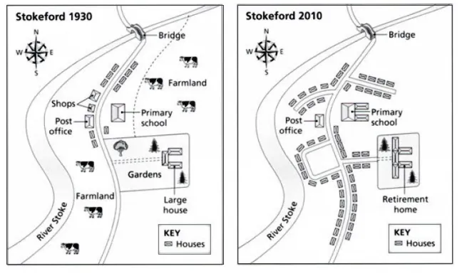
The two maps provide a comparative view of the village of Stokeford, illustrating the changes that occurred between 1930 and 2010.
In a broad perspective, the most noticeable transformation was the expansion of residential areas and the introduction of several new facilities. The farmland, which once dominated the northern part of the village, was significantly reduced.
In more detail, the northern part of Stokeford underwent a major transformation. The large farmland was replaced by a new housing estate, and a retirement home was established where the post office previously stood. The shops were also replaced by a business park, indicating a shift towards commercial development.
On the other hand, the southern part of the village saw the construction of more houses replacing the gardens. The old large house was converted into a residential home. However, the primary school remained a constant in the village structure over the years, indicating the sustained importance of education in the community.