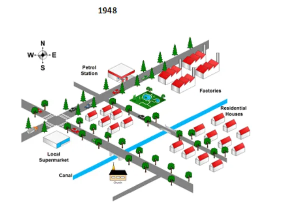
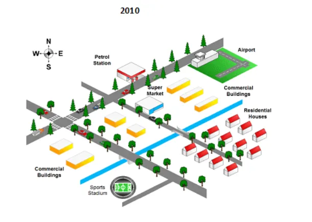
The provided maps illustrate the transformation that took place in an American town from 1948 to 2010.
The most noticeable changes over the six-decade period are the expansion of residential areas and the development of new facilities, such as a shopping mall and a sports ground. The town's infrastructure also underwent significant modifications, including the construction of a new road and railway line.
In 1948, the town was relatively small with a few houses, a school, and a factory. There was a main road running north-south, but no railway line. By 2010, the residential area had expanded dramatically, covering the entire western part of the town, and the school had been replaced by a shopping mall. The factory had been relocated to the south, making room for a sports ground.
Furthermore, a new road was built to the east of the town, connecting it with a newly established railway station. The railway line, running parallel to the new road, was another significant addition to the town's infrastructure. This development, along with the expansion of residential areas, indicates substantial growth and modernization of the town over the period.