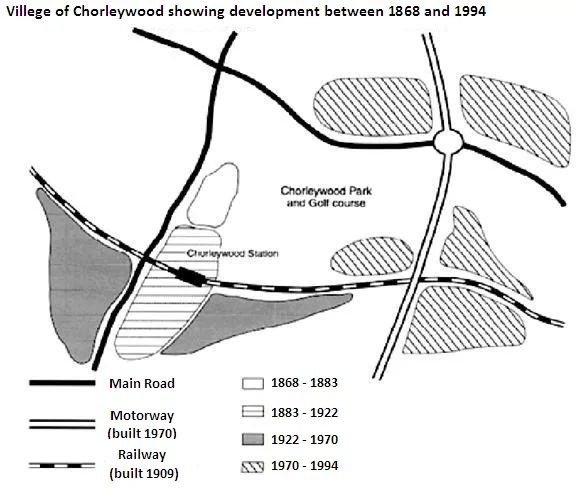
The provided map illustrates the progressive expansion of the village of Chorleywood, situated near London, from the mid-1800s to the present day.
The most noticeable trend is that the village has been constantly growing over the years, with significant developments in the transportation infrastructure and residential areas. The map reveals a clear correlation between the development of the village and the advent of new transportation links.
In the initial stage, from 1868 to 1883, the village expanded around the railway, which was the only mode of transportation. The development was mainly concentrated in the south-eastern part of the village. However, between 1922 and 1970, with the introduction of motorways, the village saw a significant expansion towards the west and north. The residential areas were developed along the motorway, indicating the influence of transportation on the growth of the village.
In the final phase, from 1970 onwards, the village expanded further to the west with the construction of the M25 motorway. This period also saw the development of the golf course in the south-western part of the village. Thus, the map clearly shows the steady growth of Chorleywood village, heavily influenced by the evolution of transportation infrastructure.